's-Heerenberg
's-Heerenberg | |
|---|---|
City | |
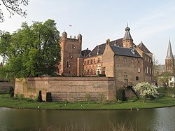
 's Heerenberg castle. | |
| Coordinates: 51°52′35″N 6°14′45″E / 51.87639°N 6.24583°E | |
| Country | Netherlands |
| Province | Gelderland |
| Municipality | Montferland |
| Area | |
• Total | 3.40 km2 (1.31 sq mi) |
| Elevation | 17 m (56 ft) |
| Population (2021)[1] | |
• Total | 8,635 |
| Time zone | UTC+1 (CET) |
| • Summer (DST) | UTC+2 (CEST) |
| Postal code | 7041[1] |
| Dialing code | 0314 |
's-Heerenberg is a city on the Dutch-German border, in the Province of Gelderland, Netherlands. It is located about 5 km north of the German Emmerich, and about 12 kilometres (7.5 mi) south of Doetinchem. It received city rights in 1379.
's-Heerenberg is the location of one of the most important castles of the Netherlands: Huis Bergh. The Huis Bergh contains a panel of the Archangel Gabriel from the famous altar piece Maestà by Duccio. The castle is surrounded to the west by a forest, part of the larger nature reserve Bergherbos.
Mechteld ten Ham was accused of sorcery. She demanded a trial, and failed the water test, because she remained floating on the water. During torture, she confessed to being a witch, and was burnt at the stake on 25 July 1605. In 2004, a statue was revealed in her honour.[3] In 2015, her statue was set on fire.[4]
Until 1821 's-Heerenberg was a separate municipality; it then became the administrative center of Bergh. Since 2005 it is part of the municipality of Montferland.[5] The border canal 'Grenskanaal' constitutes the border to Germany. Industrial parks 't Goor and the Immenhorst are situated near this border.
The annual Montferland Run road running competition is held in 's-Heerenberg every December. The race has been previously won by world-class runners like Haile Gebrselassie, Kenenisa Bekele, Lornah Kiplagat and Paula Radcliffe.
Gallery
[edit]-
's-Heerenberg
-
City wall
-
Boetselaersborg
-
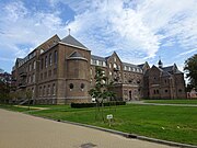
Former monastery Don Rua
-
City parc at the monastery
-
City parc at the monastery
-
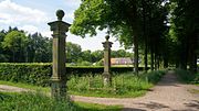
Parcs of Huis Bergh
-
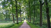
Bergherbos
References
[edit]- ^ a b c "Kerncijfers wijken en buurten 2021". Central Bureau of Statistics. Retrieved 23 March 2022.
- ^ "Postcodetool for 7041AA". Actueel Hoogtebestand Nederland (in Dutch). Het Waterschapshuis. Retrieved 23 March 2022.
- ^ "Mechteld ten Ham". Mijn Gelderland (in Dutch). Retrieved 23 March 2022.
- ^ "Beeld 'Heks' in 's-Heerenberg verbrand". Regio 8 (in Dutch). 29 July 2015. Retrieved 23 March 2022.
- ^ Ad van der Meer and Onno Boonstra, Repertorium van Nederlandse gemeenten, KNAW, 2011.


